
Key Features
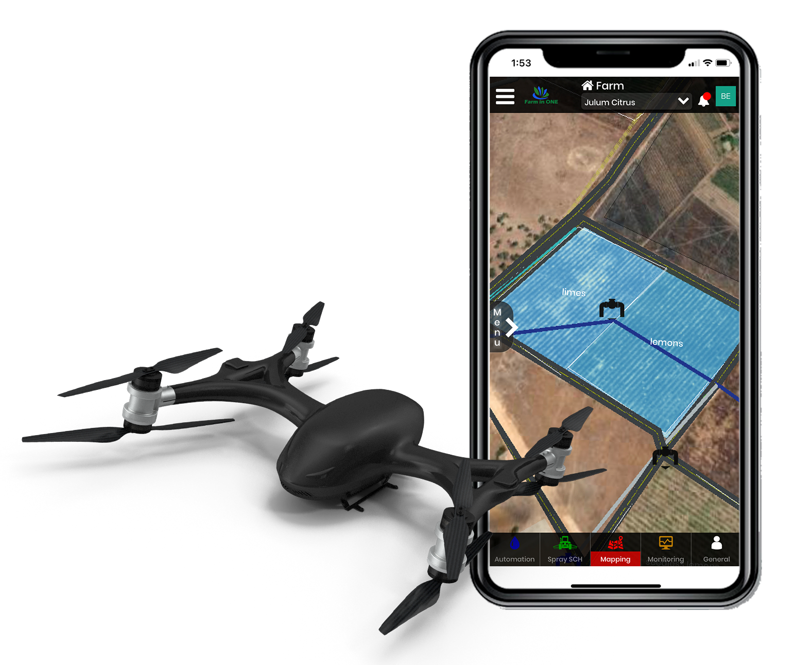
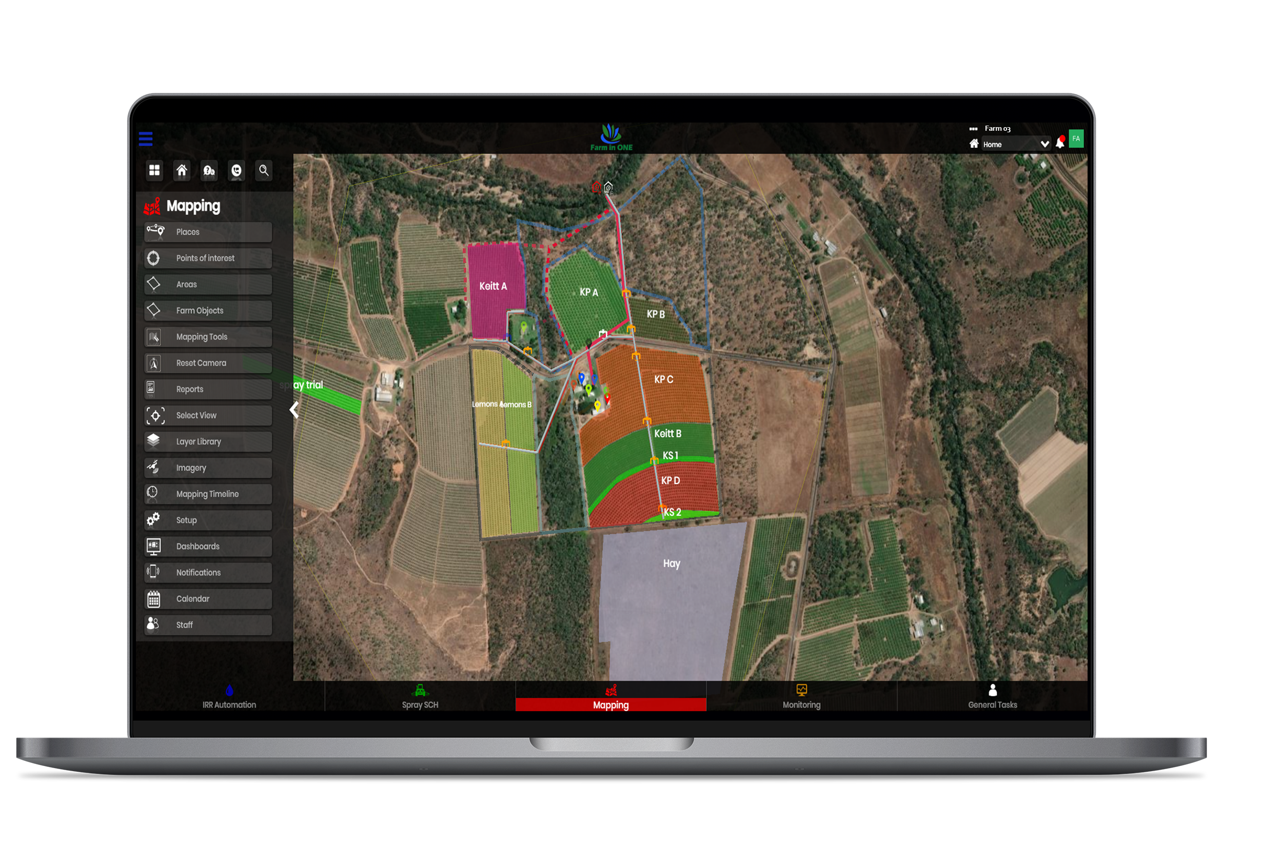
Mapping
Input all plant & block information
Record harvested events by blocks
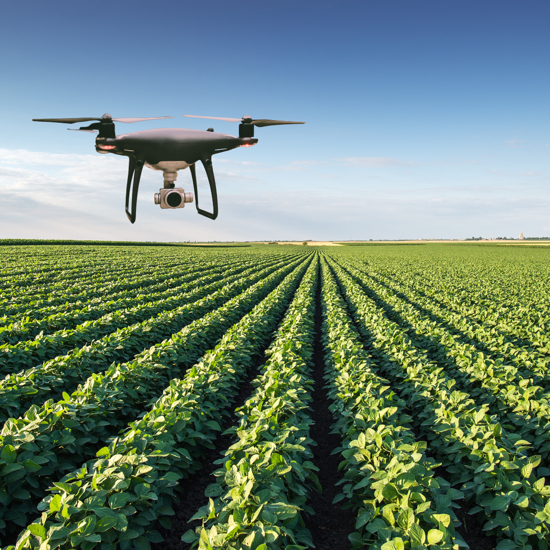
Use NIR/multi-spectral imagery to maximise farm management
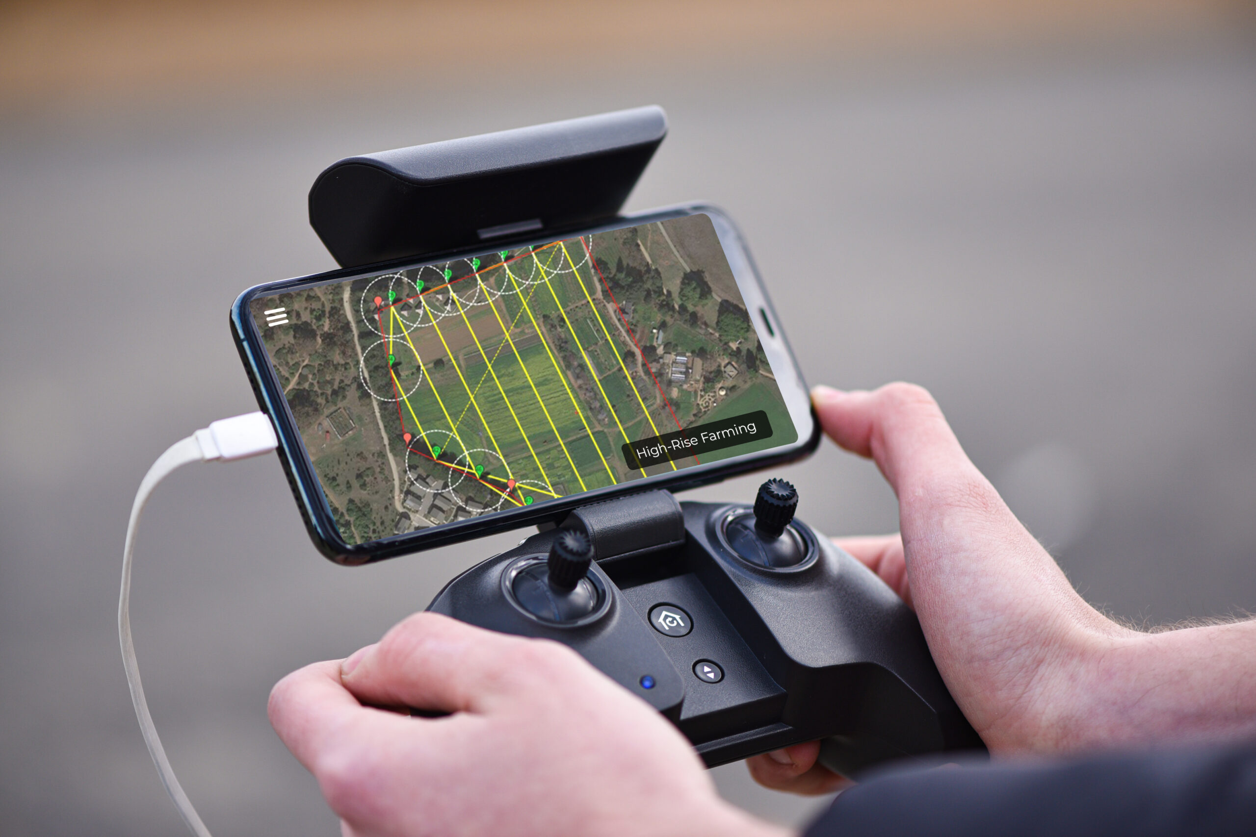
Import KML & shape mapping file
Download drone imagery
Create & overlay layers for customised farm overview
Complementary with any other Farm in ONE module
Key Features
Mapping
Input all plant & block information
Record harvested events by blocks
Use NIR/multi-spectral imagery to maximise farm management
Import KML & shape mapping file
Download drone imagery
Create & overlay layers for customised farm overview
Complementary with any other Farm in ONE module
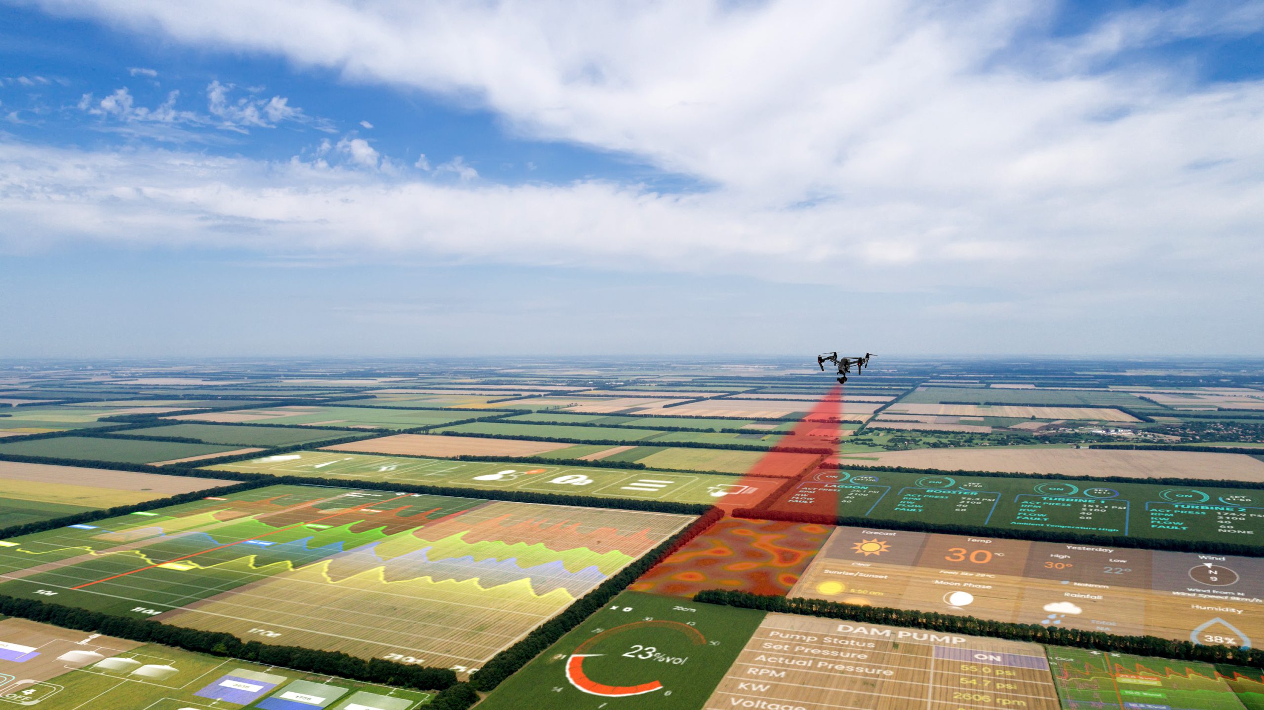
Monitoring from the Sky using Multi-Spectral Imagery for Precision Farming
Precision technology is driving the farming revolution, and monitoring from the sky is vital to inspect plant and crop health.
Aerial imagery can provide the following:
- Dimensionally accurate photomaps,
- 3D maps with accuracy equal to RTK GPS systems, and
- Multi-spectral crop health maps.
Accurate maps highlight which areas of your crop need closer examination, meaning less time spent scouting.
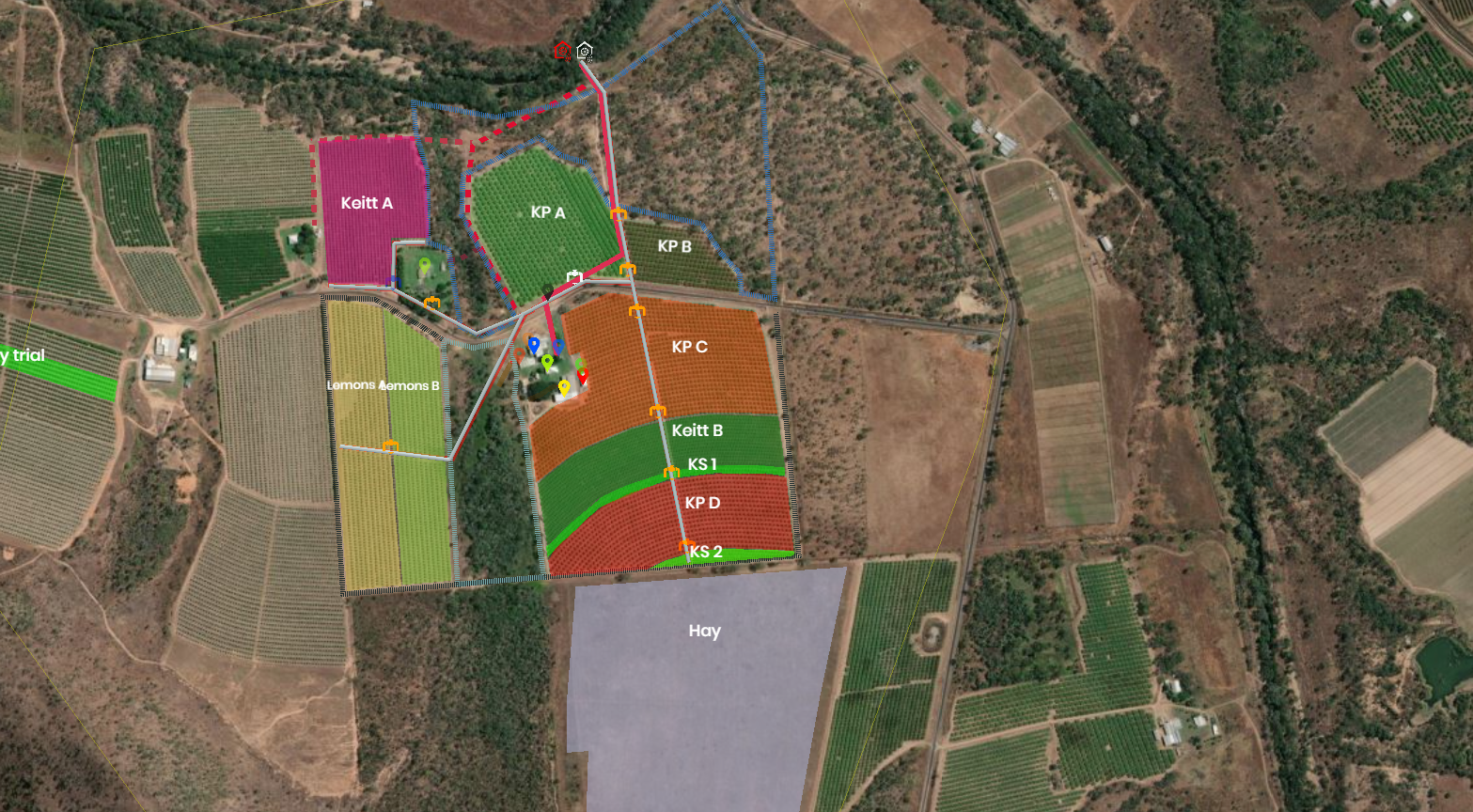
Farm in ONE offers an elite interactive mapping platform that covers multiple farm activities. The mapping system can interact with other packages on the platform and create imagery files via drones, tractors and satellites.
Aerial imagery analysis allows you to build and execute a precision plan to get the best out of your crops. The ultra-high-resolution imagery from unmanned aircraft complements the intense management practices in farming systems used in horticulture and mixed cropping. Functions include layered mapping, adding areas, drone and global imaging, added crop information in the block, and locating devices or sites on the farm.
Precision from the Sky
Precision from the Sky
The Mapping Module integrates with other Farm in ONE modules providing a detailed aerial overview of your farm.
The Mapping Module integrates with other Farm in ONE modules providing a detailed aerial overview of your farm.
Data-driven Decision Making
Import drone data from 3rd party contractor.
Capture accurate, high-resolution data for monitoring and decision making.
Survey and access farm data dam sites accurately at low cost.
Map out blocks and multiple layers.
Drone imagery file importing.
Data-driven Decision Making
Import drone data from 3rd party contractor.
Capture accurate, high-resolution data for monitoring and decision making.
Survey and access farm data dam sites accurately at low cost.
Map out blocks and multiple layers.
Drone imagery file importing.
Crop planting information.
Use multi-spectral imaging to assess crop health from planting to harvest.
Optimise irrigation and drainage with 3D imaging.
Make informed decisions on crop health with up-close aerial imagery.
Crop planting information.
Use multi-spectral imaging to assess crop health from planting to harvest.
Optimise irrigation and drainage with 3D imaging.
Make informed decisions on crop health with up-close aerial imagery.
Mapping Imagery
Eagle Eye View
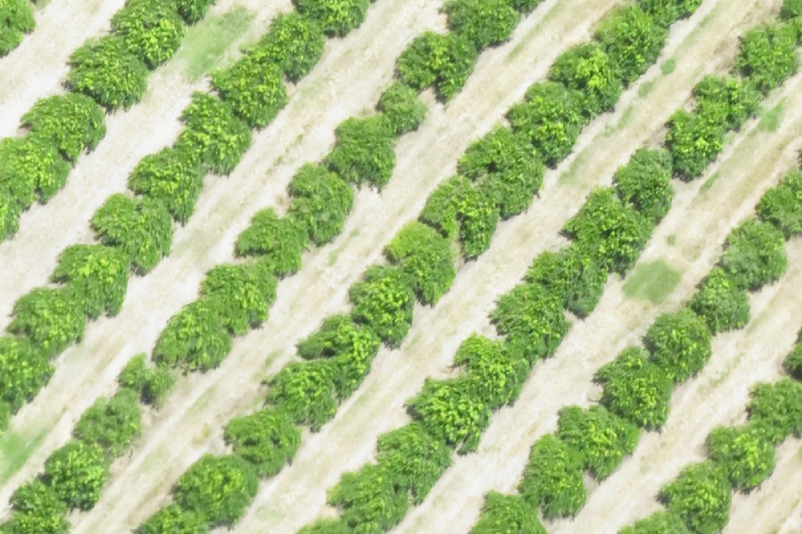
RGB Image
Drone Mapping
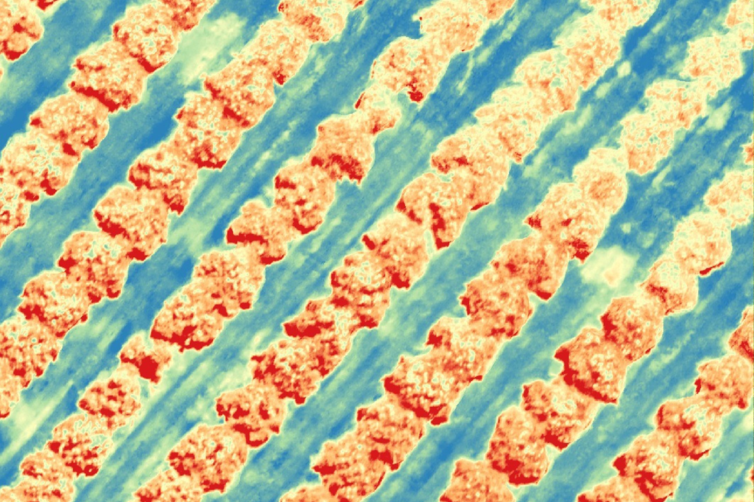
NIR/Multi-Spectral Image